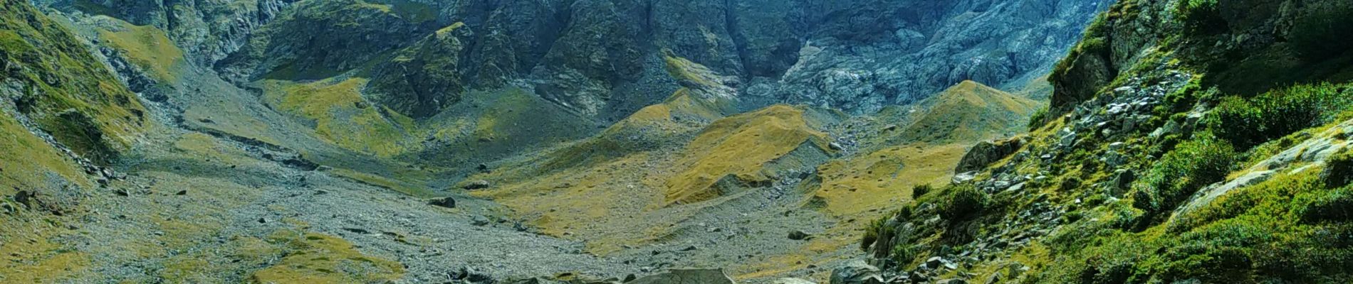
Refuge Chanbourneou Vallonpierre

Surfou
User
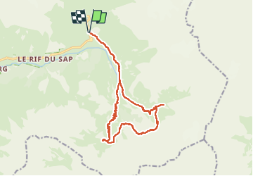

Length
18.3 km

Max alt
2290 m

Uphill gradient
978 m
Km-Effort
31 km

Min alt
1547 m

Downhill gradient
973 m
Boucle
Yes
Creation date :
2022-08-15 07:12:10.928
Updated on :
2022-08-15 14:22:10.169
6h08
Difficulty : Very difficult

FREE GPS app for hiking
 SityTrail
IGN / Geographical institutes
SityTrail Plus
The world is yours!
About
Trail Walking of 18.3 km to be discovered at Provence-Alpes-Côte d'Azur, Hautes-Alpes, La Chapelle-en-Valgaudémar. This trail is proposed by Surfou.
Photos

Positioning
Country:
France
Region :
Provence-Alpes-Côte d'Azur
Department/Province :
Hautes-Alpes
Municipality :
La Chapelle-en-Valgaudémar
Location:
Unknown
Start:(Dec)
Start:(UTM)
285205 ; 4968285 (32T) N.
Comments